Wotho Atoll (Wotho Atoll)
Wotho Atoll (Marshallese: Wōtto, ) is a coral atoll of 13 islands in the Pacific Ocean, and forms a legislative district of the Ralik Chain of the Marshall Islands. Its total land area is only 4.33 km2, but it encloses a lagoon of 94.92 km2. The name "Wotho" means either "entrance through the reef", or "island far away" according to different sources.
The population of Wotho Atoll was 97 in 2011.
First recorded sighting of Wotho Atoll by Europeans was by the Spanish expedition of Miguel López de Legazpi on 12 January 1565. They were charted as Las Hermanas (The Sisters in Spanish). It is likely that it had been visited earlier, in between December 1542 and January 1543, by the Spanish expedition of Ruy López de Villalobos. The atoll was later also known as Schantz Islands after Johan Eberhard von Schantz, who rediscovered the islands on his circumnavigation of the globe on the Imperial Russian Navy ship America in 1835. Wotho Atoll was claimed by the Empire of Germany along with the rest of the Marshall Islands in 1884. After World War I, the island came under the South Seas Mandate of the Empire of Japan. At the end of World War II, it came under the control of the United States as part of the Trust Territory of the Pacific Islands until the independence of the Marshall Islands in 1986.
Map - Wotho Atoll (Wotho Atoll)
Map


Country - Marshall_Islands
 |
 |
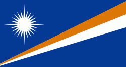
| Flag of the Marshall Islands | |
The country's population of 42,050 people (at the 2021 World Bank Census ) is spread out over five islands and 29 coral atolls, comprising 1,156 individual islands and islets. The capital and largest city is Majuro. It has the largest portion of its territory composed of water of any sovereign state, at 97.87%. The islands share maritime boundaries with Wake Island to the north, Kiribati to the southeast, Nauru to the south, and the Federated States of Micronesia to the west. About 52.3% of Marshall Islanders (27,797 at the 2011 Census) live on Majuro. In 2016, 73.3% of the population were defined as being "urban". The UN also indicates a population density of 295 PD/km2, and its projected 2020 population is 59,190.
Currency / Language
| ISO | Currency | Symbol | Significant figures |
|---|---|---|---|
| USD | United States dollar | $ | 2 |
| ISO | Language |
|---|---|
| EN | English language |
| MH | Marshallese language |